Land Registry Polygon Downloader
Free, instant access to registered land parcels — no GIS software required
Introduction:
Finding out exactly which parcels of land are registered near a site used to mean digging through HM Land Registry's portal, identifying the right local authority, downloading a dataset covering an entire council area, unzipping the dataset, and then importing it into GIS software just to see the handful of parcels you actually needed.
This tool does all of that in one click.
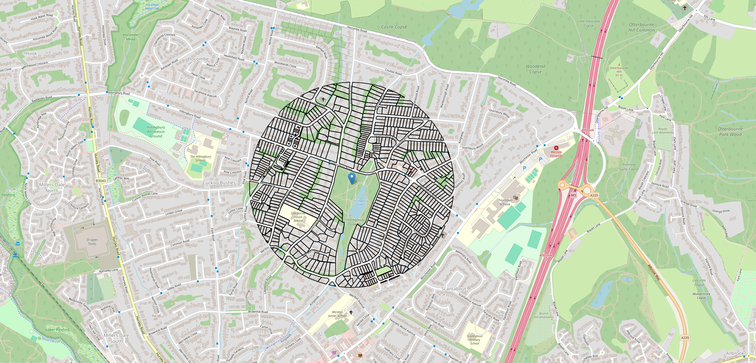
Plot a point anywhere in England or Wales, and instantly see every registered land parcel within 500 metres — viewable right in your browser, or downloadable as a ready-to-use file for your own GIS software.
How to use it:
Click a point on the map at the location you're interested in.
View the results — registered parcel boundaries within 500m appear instantly, drawn directly on the map.
Download the data — click "Download GeoPackage" to get a file ready to drop straight into ArcGIS, QGIS, or any other GIS software.
Why this beats the manual process:
Getting this same data the traditional way means:
Searching HM Land Registry's INSPIRE Index Polygons service by hand
Correctly identifying which local authority your site of interest falls under
Downloading that council's entire dataset — often covering hundreds of square kilometres — just to find one small area
Unzipping and converting the file format from GML to Geopackage so that it's usable in most GIS software
Manually clipping it down to the small area you actually care about
That's several minutes of manual work, repeated every single time, for a result you could get in seconds. This tool automates the whole pipeline — locating the right council, fetching the data, and clipping it to exactly the area you need — so you get straight to the part that matters: the parcels near your site.
This tool uses HM Land Registry INSPIRE Index Polygons data, licensed under the Open Government Licence. Contains OS data © Crown copyright and database rights, Ordnance Survey 100026316.